Snowdon- The Long Way Round
When you are planning on climbing one of Britain's infamous mountain peaks you have 2 distinct choices. Number 1 is to follow the crowds. Make a day of it with the tourists and other climbers. Follow an easy path and go home to tell your friends and family you've climbed Snowdon. The second choice is to push yourself to climb it in one of the more unusual ways. There are many well trodden paths the Yr Wyddfra's summit and don't take any of them lightly. The mountain can kill. No joke. Last year I saw people climbing it in sandals with no water or food. Don't underestimate it.

Walking through Maesgwm
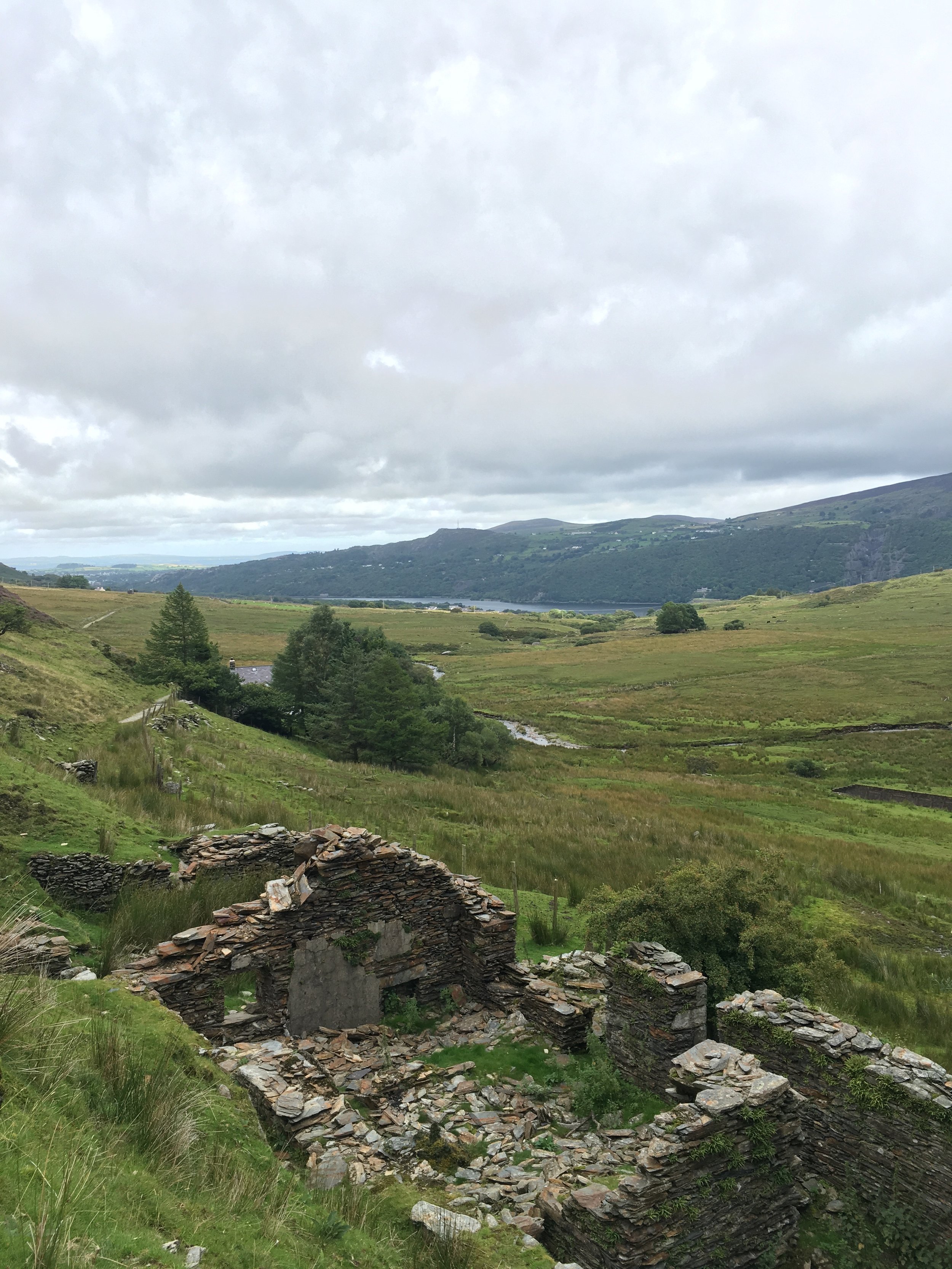
Abandoned miners cottages in Maesgwm
I took choice number two. My route started in the town of Llanberis. Famous for its hydroelectric power station, mountain railway and being the town which sits in Snowdon's shadow. Car parking is easy to find and doesn't set you back too much. Once you've gathered your kit together walk down the High Street and follow the signs towards the Youth Hostel. Even better sleep at the hostel the night before! Pass the hostel and the road soon becomes a farm track heading uphill steadily. The road/track on some maps is called Stryd Ceunant. Pass the farm on the left and head into valley which the Afon Arddu makes it pass. Over to the left you can see the Snowdon Mountain Railway chugging up the North West side of Snowdon. Follow your path through the pass of Maesgwm. On your right is Cefn Drum and ahead of you is Moel Cynghorion. The later is your first peak of the day. Once you're at the head of the pass you will see a fence on the left. Walk alongside this fence. The ground here can be quite boggy so sure footing may be hard to find. The last thing you need is a twisted ankle. Snowdon is coming!
Follow the fence all the way to the summit. This is one of the best viewpoints of the whole walk. Over the fence you can see down the Maesgwm Pass from where you've just come from and down towards Llanberis. The the right you can look down towards the flat part of the Snowdon Ranger path and the Llyn Ffynnon-y-Gwas reservoir.

Descending Moel Cynghorion
Keep the fence to your left and you'll soon start to drop downhill. Quickly. In front of you in the reservoir and the foot of the Clogwyn D'ur Arddu (the far west buttress of Snowdon). Once you've made it down you join the Snowdon Ranger path. There is some craggy rocks here to perch on and maybe grab some lunch from your bag. It is a perfect time to stop as you're now about the start the long climb up the Ranger Path to the summit of Snowdon.
The Ranger Path zig-zags its way up the mountain. You are now amongst other walkers and sometimes crowds so take your time and respect each others space. Remember that people use the mount for fitness and health so try not to get in way of people who appear quicker than you. We met someone running up the path last year with a backpack full of kit!

Climbing the Ranger Path

Looking back at the summit of Yr Wddfra
The climate changes and you are soon surrounded by loose slate and less and less grass. When you think you've left all live behind you'll round a corner and be met by a sheep! The path carries on and on but soon you'll start hearing the mountain railway and it spurs you on to finish what you've started. When the ground starts to flatten you cross the tracks and join the tourists on the Llanberis path towards the summit. The weather can be cruel. Sometimes it can be so misty you can't see the person in front of you but just take a seat on a rock and wait. The clouds roll through and most of the time you'll get a brief moment of clarity. When you do it's worth all the climbing. Views all around Snowdonia and beyond.

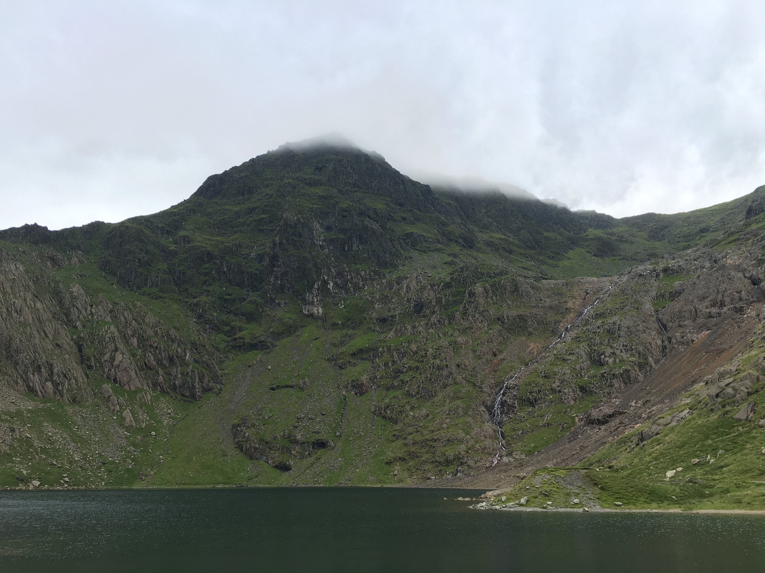
Glaslyn Lake
On the descent you've got a few options. You can continue straight and join the Llanberis path which takes you back to the starting position or you can take a right fork and walk down Llwbr y Mul, (The Zig Zags). This path is a very step set of carved steps falling down the mountain side towards the Glaslyn Lake and is follows the Afon Glaslyn down from the summit. Remember to look behind you as the views looking up are just as good. The track forks again and you again take the right and you join the Miners Track. This takes you around the lakes and rivers in the Cwn Dyli areas. The path becomes flat and relaxing. Its a perfect way to end the day and give your legs a rest.
The miners track takes you around the River Glaslyn and its lakes
The hike finishes at Pen-y-Pass where you can get the bus back to Llanberis for a few quid. The bus may seem an odd ending but the walk past the lakes is more relaxing than following the crowds back down the Llanberis path.
Let me know if you try this or have any comments. Share your stories and adventures with me!