
The Whispering Mountain
Mam Tor, in Old English, translates to Mother Hill. Once you've walked it you can understand why it was named as such. It has had a dramatic influence on the area for 1000's of years and is still having one to this day.
Due to its location at the southern tip of the Dark Peak area of the Peak District, and almost on a Northern spur of the White Peak area, it is a popular haunt for walkers, trekkers and ramblers. We just had to share this amazing place with you! On a clear day you can see Manchester city centre from the peak. As you can see from our photos, our day was far from clear!

Here's a geography lesson for you.... The rocks that Mam Tor is built from are what is left of a coral reef from the Carboniferous Age, around 320 million years ago. Due to there being black shale rock underneath heavy, turbiditic sandstone, landslips have been commonplace over the last 1000 years and are also well documented. With this in mind, it is surprising that a through road from Sheffield to Chapel-en-le-Firth was present at the foot of Mam Tor from the 1800's. Inevitably it needed numerous repairs, over the years, due to slips. A large landslip in 1979 was one slip too many, and the road was closed to traffic. This walk though takes you on the road so at least we can still enjoy what nature has claimed back.

The flagstone steps the to summit
The hike we went on is adapted from a National Trust walk. The route gives you some of the best views across the Dark and White Peak areas and across Edale Valley. You can also see down towards the limestone gorge of Winnets Pass, which is only a stones throw away.

The walk begins at the Mam Nick car park. It is a National Trust owned car park which costs a very reasonable, £3 for the day.
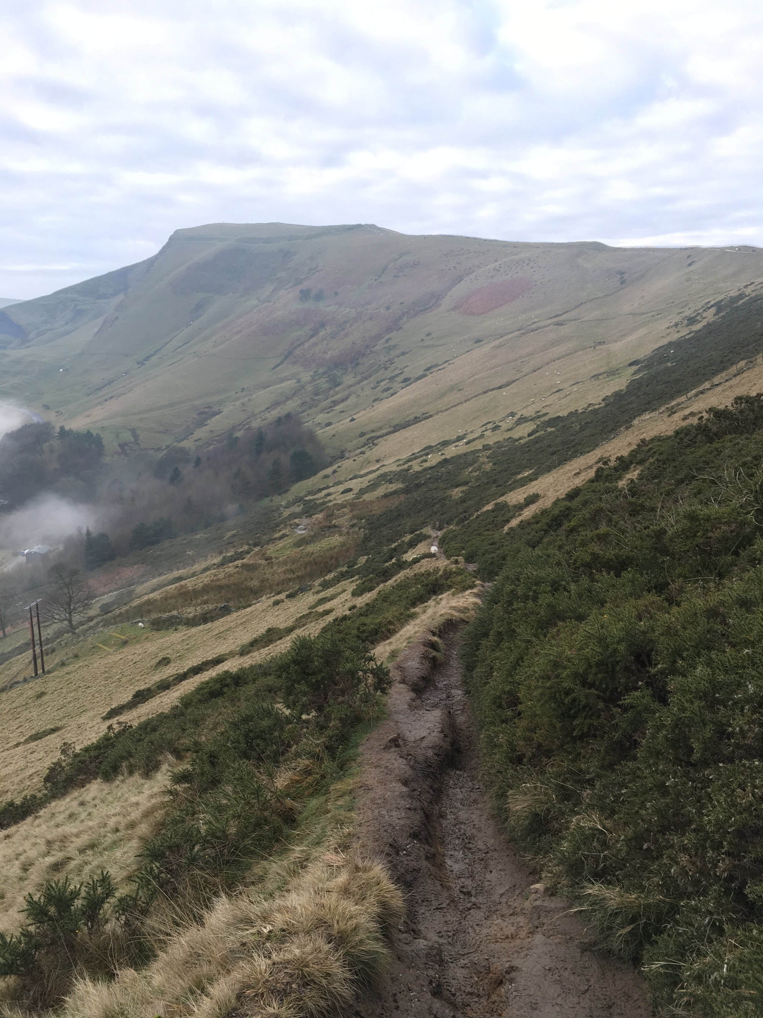
Climb the steps at the rear of the car park and follow the path uphill alongside the road which eventually drops into Edale Valley. On your left is the bottom of Mam Nick. Continue up the hill and through the gate once the road falls away from you and into the valley.

The Edale Road

Continue uphill, climbing the flagstone steps. Remember to look behind you, as one of the best views of Mam Nick and Edale is there! The ground begins to level out and you are at the summit of Mam Tor. Up here you can see the unstable shale cliffs which have made the area so infamous.
At the summit is a stone marker. Rest here and take advantage of the amazing 360° views across Derbyshire. The day we did it, it was very foggy but that just added to the marvel. We saw the fog and mist below us rolling into Winnets Pass like it was alive! The Edale valley was clearer and we could see the entire valley without obstruction.
Continue along the flagstone path. This follows the ridge and you can carry on looking across the hills and valleys in front of you.

The path climbs and falls as you make your way towards an intersection. On your right you can see across to Winnets Pass and the Blue John Cavern. Look down the cliff on your right and you have a great view of what is left of the aforementioned, doomed road.


View of the closed road.
To your left is Edale and its green pastures and rich farmland. Before the path gets noticeably steeper you will reach Hollins Cross. See a gate on your right and pass through it, then choose the right fork and walk down the hill through farmland.
Walking through the farmland back towards Mam Tor
The ground is steep and can be wet and muddy. Numerous streams flow down from the ridge which can make the route treacherous.

Pass through some fields until you reach a small wooded area. Take the path to the right of the trees and skirt around the edge of the woodland. Continue on this path until you reach the road.

The National Trust do a great job protecting some of our most beautiful places.
Walk through the gate and up the broken road. To your left you can see Castleton through the hills. The road is safe for people to walk on but take a moment to look at how strong nature is!


The road markings are still visible on the road surface.
At the top of the hill you will see the Blue John Cavern. Take the road towards to cavern and then you'll see a grassy path to the right of the building.

Follow this path up a hill and then go through a gate. Cross another field and then cross a road. In the next field take the left fork of the path towards another cave. This cave is called Windy Knoll and should not be entered. Recent rock falls have made it very dangerous.

Observe Windy Knoll from the outside.
Then cross the field, walking away from the cave and then cross the road. Turn left and walk along the verge for about 100 metres back to the car park.
This walk is not that challenging so it can be enjoyed with people of different fitness levels and experience. The views are fantastic and it is great just to be outside enjoying the fresh air.
Thanks to The National Trust this route was well maintained with great gates, stiles and car parking, without distracting from being outside in the wilderness.
If you try this walk let us know how you get on.